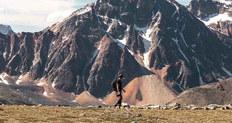
Summer in Jasper National Park evokes thoughts of fresh alpine air, hiking boots hitting forest trails and, of course, a camera roll full of mountain beauty. Whether you’re new to hiking or tight on time, these five trails deliver scenery to leave you more than satisfied, all in short order.
Ride the Jasper SkyTram to the top of Whistlers Mountain, and boom — the hard work is done! The view from the Upper Station’s boardwalk (2,263 metres above sea level) is remarkable on its own, but you can take this adventure even higher. Walk the summit trail to the true mountaintop and soak in the stunning views of Jasper National Park and peaks galore from an elevation of 2,463 metres.
Round-trip distance: 2.8 km (1.7 miles)
Elevation gain: 200 metres (656 feet)
Time to hike: 1-2 hours
Trailhead: The Jasper SkyTram is located south of town off Whistlers Road. Ride the tramway then follow signs to summit.

Enter a land of ice as you marvel at Angel Glacier and the turquoise water below in Cavell Pond. If you’re up for it, extend your hike through Cavell Meadows (7-kilometre return, 500-metre elevation gain, 3 to 5 hours).
Fun Fact: Edith Cavell was a British nurse who helped Allied prisoners escape occupied Brussels during World War I.
Round-trip distance: 1.4 km (0.85 mile)
Elevation gain: 70 metres (230 feet)
Time to hike: 1 hour
Trailhead: The end of Cavell Road, off Highway 93A south of Jasper townsite.

Head south of town on the Icefields Parkway to explore these breathtaking lakes with jewel-coloured water (they get their hue from glacial rock flour as well as algae). You can hike to all five lakes or enjoy a shorter jaunt to just one or two.
Round-trip distance: 4.5 km (2.8 miles)
Elevation gain: 66 metres (216 feet)
Time to hike: 2 hours
Trialhead: 9 km (5.6 miles) south of Jasper townsite on Highway 93.

Discover Jasper’s deepest canyon, complete with waterfalls and bridges, on this classic trail for those of all experience levels. Choose how far you venture, but don’t miss the second bridge — it’s the canyon’s highest point.
Please note: The Maligne Canyon area has been affected by recent wildfires and is currently unavailable. Check the Parks Canada website for the latest information on what’s open.
Round-trip distance: 3.4 km (2.1 miles)
Elevation gain: 118 metres (387 feet)
Time to hike: 1-2 hours
Trailhead: Take Maligne Lake Road off Highway 16 to Maligne Canyon parking area.

This trail is close to town and offers a bird’s eye view of the townsite as well as many lakes in the area, and of course, mountains. The loop can be hiked in either direction. Be mindful of some steep sections and watch for wildlife — bighorn sheep are commonly spotted in the area!
Round-trip distance: 3.8 km (2.4 miles)
Elevation gain: 130 metres (426 feet)
Time to hike: 1-2 hours
Trailhead: South of Jasper townsite on Hazel Avenue. Turn left south of the intersection with Highway 16.

Hiking is a fantastic way to appreciate the landscape in Jasper — and we can all be stewards of our environment’s natural beauty. To help you do so, here are our top three tips for hikers.
All this information plus trail conditions can be found on the Jasper National Park website. Happy trails!
Insider tips, inspiration and deals — delivered straight to your inbox.